Search This Blog

Tuesday 30 April 2013

List of most beautiful beaches in Brazil

One of the major attractions in Brazil is the beaches located in different parts of the country.Brazil is known to have some of the best beaches in the world.It's tropical coast, lines more than half of our country, making home to very diverse and beautiful beaches.

Where is Brazil?
Brazil is the largest country in both South America and the Latin America region. It is the world's fifth largest country, both by geographical area and by population, with over 193 million people.It is the largest Lusophone country in the world, and the only one in the Americas.
 https://encrypted-tbn2.gstatic.com/images?q=tbn:ANd9GcQCa8_43azKGUhrC_wkld9OU52ByllSNUxll2RZqS-ikU5xCy5t
 Bounded by the Atlantic Ocean on the east, Brazil has a coastline of 7,491 km (4,655 mi).It is bordered on the north by Venezuela, Guyana, Suriname and the French overseas region of French Guiana; on the northwest by Colombia; on the west by Bolivia and Peru; on the southwest by Argentina and Paraguay and on the south by Uruguay.

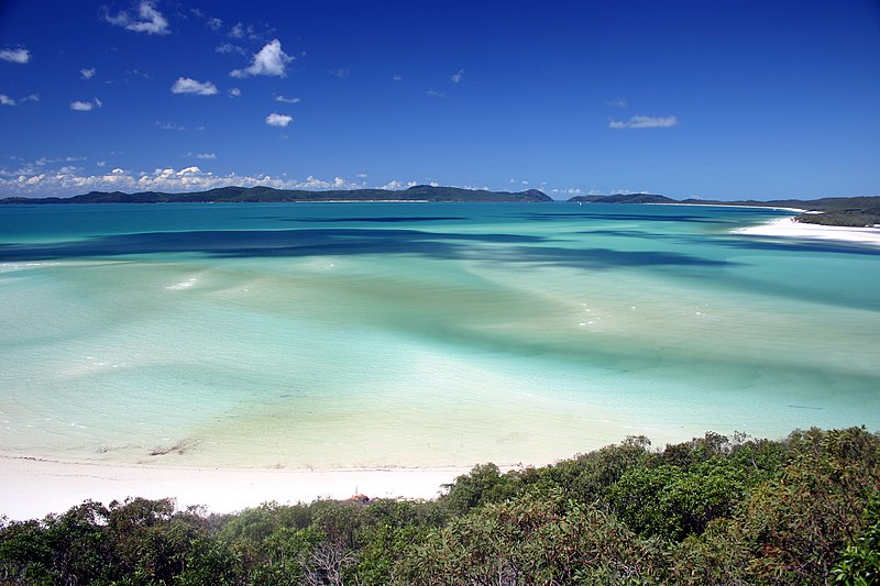
Are you up to spend vacation in Brazil?I have listed some beautiful beaches that must see in Brazil.
There are numerous of beautiful paradise beaches in Brazil,here are just some of them:-

(pls click on the beach link below)

Rio de Janeiro
Niterói
São Sebastião
Ceará
 
Rio Grande do Norte

Tobacco Bay beach,St.Georges,Bermuda

Tobacco Bay beach, Tobacco Bay in St. Georges,Bermuda.

File:Tobacco Bay 4.jpg 
  •  One of Bermuda's national parks, it is a popular public beach. Snorkelling is a popular activity, as the bay has impressive underwater coral reefs, which explains its popularity with those who snorkel

Sunday 28 April 2013

List of paradise beaches in Bermuda

Planning for vacation in Bermuda?Bermuda beaches are stunningly beautiful,all of them are so unique and beautiful in their own rights! Some of the Bermuda beaches have long expanses, while some are just tiny coves that are separated from one another by rocky cliffs. Some of these beaches are surrounded by coral reefs. The reefs are generally visible above the water surface particularly during low tide. You can also clearly see them at times when you are snorkeling.

Where is Bermuda?
Bermuda, in full The Islands of Bermuda, also referred to as the Bermudas or the Somers Isles,is a British overseas territory in the North Atlantic Ocean, located off the east coast of the United States.


List of Bermuda's best beaches

Horseshoe Bay beach,Bermuda

Horseshoe Bay is perhaps the most famous beach in Bermuda. It has been rated the #8 beach in the world by TripAdvisor. It lies on the main island's south (Atlantic Ocean) coast, in the parish of Southampton.
File:Horseshoebay.Bermuda.JPG
  • The sand of the beach is very fine and displays a very white colour. 
  • The beach is equipped with one lifeguard station which is manned during the summer between 10 AM and 6 PM.
  • There is also a café where one can purchase lunch during the summer months, toilet facilities, showers and a foot-washing area for removing sand before departing. 
  • A shuttle bus is available from 11 am to 6 pm to transport beach-goers between the beach and the nearest bus stop. It will take one down the hill for $1 and up for $2.
  •  The Government provides a special bus service for tourist at the top of the hill that leaves about every 15 minutes. This service is there from about 12 to 6 pm.
  •  If you miss the last special bus the regular buses come about every 45 minutes and run til about 10 pm. A beach volleyball competition takes place once a week in the summer months, and is a regular activity for both tourists and locals alike. 

Goff's Caye beach,Belize

Goff's Caye is a small island off the shore of Belize City, Belize. It is situated north of the English Channel and is 1.2 acres (4,900 m2) of sandy land. It sits right on the edge of the Belize Barrier Reef with waters to the south and east being only 0.6 to 3 metres deep.
File:Goffs caye island.jpg

File:Goffs Caye-Belize.JPG
  • The ecosystem around Goff's Caye is very important to fisheries by producing lobster, conch and finfish. 
  • The area north of the island is also known to be a foraging area for sea turtles.
  • The reef off Goff's Caye are considered to be one of the best representatives of a healthy reef system.

Laughing Bird Caye beach,Palencia,Belize

Laughing Bird Caye is an island off the coast of Placencia, Belize. On 21 December 1991, Laughing Bird Caye National Park was declared. It is spread over an area of 1.8 acres (0.73 ha). The national park is named after the Laughing Gull which breeds there.
File:Laughing Bird Caye, Belize.jpg

File:Laughing Bird Caye, Belize 2.jpg


Half moon beach,Half moon caye island,Belize

Half Moon Caye is an island and natural monument in Belize.It boast beautiful coast,secluded & pristine beach.
File:BZECAYE.jpg

List of Belize beaches

Belize City is the largest city in Belize, and it is the place where most people arrive when visiting on vacation. Those looking for long stretches of white sand beaches may be surprised to find that Belize City really doesn't have any. Most of the nation's coastline is covered in mangroves, and sandy spots to stretch out in the sun and play in the clear Caribbean waters are few and far between.

Where is Belize?
Belize is a country located on the northeastern coast of Central America. It is the only country in the area where English is the official language, although Kriol and Spanish are more commonly spoken. Belize is bordered on the north by Mexico, to the south and west by Guatemala and to the east by the Caribbean Sea. Its mainland is about 290 km (180 mi) long and 110 km (68 mi) wide.

here's a list of Belize's beaches:-

Mainland beaches


Popular Islands


Orchid Bay, Corozal,Belize

Orchid Bay is located on the Bay of Chetumal near the town of Corozal.
 

 Enjoy all the modern conveniences of home-town living in year-round warm weather with gentle breezes that invite you swim, sail, fish, dive, snorkel, and hike amidst Mother Nature’s finest.


Almond Beach in Hopkins,Belize

Almond beach is located in the Hopkins Village, which is a coastal village in eastern Belize.
File:Almond Beach, Hopkins, Stann Creek, Belize.jpg

Almond Beach, Hopkins, Stann Creek, Belize


Maya Beach in Palencia,Belize

Maya beach is on the coast of Placencia is a small town located in the Stann Creek District of Belize

File:Beach front at Placencia, Belize.jpg

File:Maya Beach, Placencia, Belize 2.jpg

Maya Beach front


  • Placencia, it used to be a fishing village but now offers best beaches and some tourist amusement such as bars and entertainment
  • Maya beach offers activities like kayaking, snorkeling, diving, saltwater fly fishing, whale shark watching during the full moons between April and July of each year, light tackle saltwater fishing, as well as numerous restaurants and local art gallery.


Saturday 27 April 2013

Byron Bay beach,New South Wales,Australia

Byron Bay is a beachside town located in the far-northeastern corner of the state of New South Wales, Australia.
Wallpapers Trips : Oceania Australia Byron Bay, le point le plus à l'est de l'Australie


File:Byronbay.jpg


  • Baron bay has several beaches which are popular for surfing.
  • it is a resort with both domestic and international tourists, including backpackers, who travel along the Australian coast, and the scenery attracts skydivers, tandem skydiving with Skydive the Beach Byron Bay. 
  • The area is also noted for its wildlife, with the whale watching industry a significant contributor to the local economy.
  • An oceanway runs from the centre of town to the Cape Byron lighthouse.
  • visitors are encouraged to use sustainable options for moving around town like walking and cycling.
  • Temperate and tropical waters merge at Byron Bay, making it a popular area for scuba diving and snorkelling. 
  • Most diving is done at Julian Rocks which is part of the recently established Cape Byron Marine Park and only a few minutes boat ride from Main Beach.
  • Byron Bay also lies close to subtropical rainforests, and areas such as the Nightcap National Park with the Minyon Falls are all within easy reach of the town.
  • Byron Bay is now also a popular destination for Schoolies week during late November and early December.

Cottesloe Beach in the Western Australia,Australia

Cottesloe is a beach-side suburb of the city of Perth in Western Australia. It is located roughly halfway between Perth central business district and the port of Fremantle. It is famous for its beaches, cafes and relaxed lifestyle.
 File:Cottesloe beach.jpg


  • Historically the beach and its panorama are reflections of the changes in the last 110 years of Perth's history.
  •  Cottesloe Beach is a popular place for beach cricket. 
  • An oceanway allows pedestrians and cyclists to move along the beaches in a sustainable manner.
  •  In 2009, Lonely Planet named Cottesloe Beach the world's 2nd best beach for families
  • Sharks Warnings or Dangers tips from real travelers and locals in Perth, Australia.

Cable Beach in the Western Australia,Australia

Cable Beach is a 22 kilometres (14 mi) stretch of beach near Broome, Western Australia. Cable Beach was named after the telegraph cable laid between Broome and Java in 1889.


 Visitors plannig a holiday in Western Australia generally think of Broome and nearby Cable Beach ahead of any other Western Australia destination, although Monkey Mia and Shark Bay do come close to the top of the list.
sunset on cable beach,Australia


camel ride on cable beach


  • With long stretches of a white sand beach, seas of such turquoise purity, palm-fringed coast, sunset camel treks, parasailing and other water sports, sun-drenched resorts, and the air of an exotic and distant tropical eden, Cable Beach does conjure in one's mind a certainly desirable holiday destination. 
  • Take a memorable camel ride on Cable Beach.
  • There is Cable Beach Club Resort & Spa 
  •  Just a 10-minute stroll from the turquoise blue waters and crystal white sands of Cable Beach, the Pearle of Cable Beach Resort offers modern resort facilities, with luxury rooms and villas set amongst landscaped grounds.
  •  There are number of resorts & hotels nearby Cable beach providing the best beach accomodation,Moonlight Bay Suites,The Billi Cable Beach,Pinctada Cable Beach Resort & Spa,Blue Seas Resort,The Frangipani Cable Beach Broome,Old Broome Guest House

  • if you prefer a luxury stay,Oaks Cable Beach Sanctuary is offering the perfect blend of apartment style accommodation and resort style facilities. It is only a short stroll from the beautiful sandy shores of Cable Beach and a 5 minute drive from the centre of Broome and Chinatown.


Tuesday 23 April 2013

Trinity Beach,Queensland,Australia

Trinity Beach is a suburb of Cairns approximately 20 kilometres (10 mi) from the city centre. Trinity Beach is also a beach stretching for about a mile on the eastern coast of Australia. The suburb itself is approximately 1 and a half miles wide.
Trinity Beach Photos Featured Images Of Cairns Region


Monday 22 April 2013

Whitehaven Beach,Gold Coast,Queensland,Australia

Whitehaven Beach is a 7 km stretch along Whitsunday Island. The island is accessible by boat from the mainland tourist ports of Airlie Beach and Shute Harbour, as well as Hamilton Island.The beach was named and discovered in 1879 by Staff Commander EP Bedwell.The beach was awarded Queensland's Cleanest Beach in Keep Australia Beautiful's 2008 Clean Beach Challenge State Awards. In July 2010, Whitehaven Beach was named the top Eco Friendly Beach in the world by CNN.com.
File:Whitsunday Island - Whitehaven Beach 02.jpg
Whitehaven beach,viewing south of the island

File:Whitehaven beach.jpg
View north of Whitehaven beach
Whitehaven beach is one paradise white beach with clear blue water.

     
  • Whitehaven Beach is known for its white sands. 
  • The sand consists of 98% pure silica which gives it a bright white color. 
  • Local rocks do not contain silica so it has been suggested that the sands were brought to the beach via prevailing sea currents over millions of years 
  • Unlike regular sand, the sand on Whitehaven Beach does not retain heat making it comfortable to walk barefoot on a hot day. 
  • This sand is also very fine, and can damage electronic equipment such as telephones and cameras, although it is good at polishing up jewellery.
  •  Dogs are not permitted on the beach and cigarette smoking is prohibited.

Mooloolaba Beach,Sunshine Coast,Queensland,Australia

Mooloolaba is a suburb and tourist resort township on the Sunshine Coast of Queensland, Australia. It is located 97 kilometres (60 mi) north of the state capital, Brisbane, and is part of the Maroochydore urban centre.Mooloolaba derives from the Aboriginal word mulu, meaning snapper fish, or mulla meaning Red-bellied Black Snake

 Mooloolaba Queensland Australia
stunning view of sunset on Mooloolaba beach


  • .Mooloolaba is bounded on the east by the Coral Sea, on the south by the Mooloolah River, on the north by Alexandra Headland and to the west by Buderim
  • The esplanade facing Mooloolaba beach is a centre for tourist activity, containing the UnderWater World marine park, as well as many souvenir and clothing shops, bookshops, galleries and restaurants.
  • Behind the apartments facing the beach are camping grounds, backpacker hostels and canal villas

Coolangatta Beach,Goldcoast in Queensland,Australia

Coolangatta is located at the southern end of the Gold Coast on the border with New South Wales.
'Coolangatta' is derived from an Aboriginal word meaning 'splendid view'
 
  • Coolangatta is a beach-break, with waves breaking left and right, depending on conditions. Coolangatta sees a lot of surfing traffic, with surfers eager to paddle out to the Superbank surf break, which begins at Snapper Rocks, and continues at the back of this beach.
  • Beach showers and public toilets at SLSC.
  • Meals and refreshments available at the SLSC restaurant.
  • There are approx 120 car parking spaces along both sides of Marine Parade (at the northern end of the beach - more spaces available at the southern end, Greenmount Beach).
  • Queen Elizabeth Park on Marine Parade offers barbeques, picnic shelter, picnic tables, playground, toilets, water tap, drinking fountain, showers, walking track.
  • The walking trail along the beach at Coolangatta and around Kirra Point is part of the Southern Points Promenade section of the Gold Coast Oceanway walk, which is a 36 kilometre network of beach pathways.
  • You can see the big rock groyne at Kirra Point, which marks the end of Coolangatta beach. 

Four Mile Beach in Queensland,Australia

Four Mile beach is located in Port Douglas, a town in Far North Queensland, Australia, approximately 70 km (40 mi) north of Cairns.

File:Beach in Port Douglas 3.jpg
 
Kitesurfing is popular at the southern end of Four Mile Beach, particularly during the winter months when trade winds blow from the South.

Four Mile Beach (Port Douglas) is one of the best known and most popular beaches of northern Australia.This is one paradise beach not to be missed for beach-goers, surfers,fishers or swimmers.

Palm Cove beach in Queensland,Australia

Palm Cove is a beach community in Far North Queensland, Australia located 27 kilometres (17 mi) north of the city of Cairns. It is named after the palm trees that line the beach.


  • The pristine beaches and Palm tree lined paths are used by joggers, walkers and cyclists and netted life guard patrol swimming enclosures offer safe access to the sea all year round. 
  • The Palm cove jetty is one of the regions most popular fishing spots where anglers regularly catch species such as mackerel, Giant Trevally or "G.T's" and shark.

Lorne Beach in Victoria,Australia

Lorne is situated on the Victoria Surf Coast.Lorne is a seaside town on Louttit Bay in Victoria, Australia. It is situated about the Erskine River and is a popular destination on the Great Ocean Road tourist route. Lorne is in the Surf Coast Shire and at the 2006 Census in Australia had a population of 967,but this figure grows during the holiday season.


Ninety Mile Beach in Victoria,Australia

The Ninety Mile Beach is a sandy stretch of south-eastern coastline of Victoria, Australia along the Gippsland Lakes region of East Gippsland on Bass Strait. The beach is just over 151 kilometres (94 mi) long running north-eastward from a spit near Port Albert to the man-made channel at Lakes Entrance. The beach is located about 260 kilometres (160 mi) from Melbourne and can be reached from the South Gippsland Highway passing the coastal towns of McLoughlins Beach, Woodside, Seaspray, Golden Beach, and Loch Sport.

The beach has golden sand, with crashing waves and a natural bush environment that is habitat to wild dingoes, birds and other small burrowing mammals.

The beach is believed to be the third longest uninterrupted beach in the world, behind Praia do Cassino on the Brazilian southern coast and Padre Island on the US Gulf Coast.

  • Behind the beach are long sandy dunes that separate various lakes and lagoons from the ocean.
  •  In the northern section, the beach runs along a sandbar on what amounts to a series of tidal islands. 
  • Behind this are several large lakes and numerous shallow littoral lagoons. 
  • The three main lakes are Lake King, Lake Victoria and Lake Wellington.
  •  The area comprises The Lakes National Park.
  • During mating season some species of shark, including the famous Great White Shark gather in the shallow waters along the beach to breed. Signs are put up to advise visitors of this.
  • The beach's length ensures that the waves break too close to the beach for good surfing, and there are strong rip currents and cross-currents that make conditions rather hazardous

Bells Beach in Victoria,Australia

Bells Beach is a coastal locality of Victoria, Australia in Surf Coast Shire and a renowned surf beach, located 100 km south-west of Melbourne, on the Great Ocean Road near the towns of Torquay and Jan Juc.
File:Bells-Beach-View.jpg

  • High cliffs provide a dramatic backdrop to the natural amphitheatre of the beach and large swells from the Southern Ocean, which slow down and steepen over the reef-strewn shallows, create the outstanding surf.
  •  If you're a sightseer, Bells Beach is a popular spot with great vantage points along the cliff. 
  • For surfers, Bells Beach is really for the experienced. 
  • The beach is an exposed reef and point break with excellent right hand breaks, at their best during autumn and winter.
  • Bells Beach is the home of the world's longest-running surfing competition – the Rip Curl Pro Surf & Music Festival. The event was formerly known as the Bells Beach Surf Classic
File:Bells beach surfers.JPG
surfers at the Bells Beach


Tamarama Beach in Sydney,Australia

Tamarama is a beachside, eastern suburb of Sydney, in the state of New South Wales, Australia. Tamarama is 7 kilometres east of the Sydney central business district, in the local government area of Waverley Council. Tamarama is affectionately nicknamed Glamarama (or Glamourama) by the locals, as it is a beach where wannabe trend setters come to sunbathe and swim or simply try to be seen.


  • Tamarama Beach is a small beach between two prominent headlands, with a sand filled valley to the back, surrounded by pleasant parkland and picnic areas.
  •  Tamarama is an extremely narrow beach and deceptive for its size. 
  • Tamarama Beach is often referred to as Glamarama (or Glamourama), owing to the alleged abundance of glamorous people who sunbathe (often topless), on what must be one of the smallest strips of sand in the state.
  •  Tamarama Surf Club is located on the northern side, perched up on the headland where it overlooks the entire beach.
  •  Because of its deep water, small size and easterly aspect, Tamarama is dangerous for most swimmers even in a moderate ocean swell. 
  • When swimming at Tamarama beach the directions of the surf life savers should not be ignored. Tamarama is considered the most dangerous patrolled beach in New South Wales.
 File:TamaramaBeach.jpg

Bronte Beach in Sydney,Australia

Bronte Beach is a small but popular recreational beach located on Nelson Bay in Bronte in the eastern suburbs of Sydney, Australia. It is 2 kilometres south of Bondi Beach and north of the much larger Coogee Beach.
beautiful Bronte beach during the daytime

panoramic view of Bronte beach

  • The beach is popular with surfers and despite the often rough surf, less abled swimmers can avail themselves of the bogey hole or rock pool towards the southern end of the beach. 
  • At the south end of the beach is a 30 metre ocean pool, one of the best known in Sydney. Directly opposite the beach are popular cafes. 
  •  The beach is patrolled by Waverley Council full-time lifeguards on a daily basis (except during winter) and volunteer lifesavers from the life saving club on weekends and public holidays.
  • A public park adjoins the beach, with provision of picnic seats and barbecue hotplates, although parking is limited and restrictions are strictly enforced.
  •  The beach is served by the number 378 Sydney City Bus from Sydney's Central railway station or the 378 bus from the Bondi Junction station. 
  • The beach is shaded by hills to the west and tends to become cool, windy and deserted towards the end of the afternoon.
  • The beach is widely represented in literature. Sylvia in Kathleen Stewart's Spilt Milk (1995) regularly walks the cliffs. Poets have often found voice on its sands.

Travel Blogs

Blog Archive