Search This Blog

Saturday 25 May 2013

List of beaches in Equador

With 2,237km coastline,Equador boasts a number of beautiful beaches.Equador beaches offer many type of activities like surfing,sailing,fishing ,diving or snorkling.Ecuador is one of the twenty most bio-diverse countries on earth.

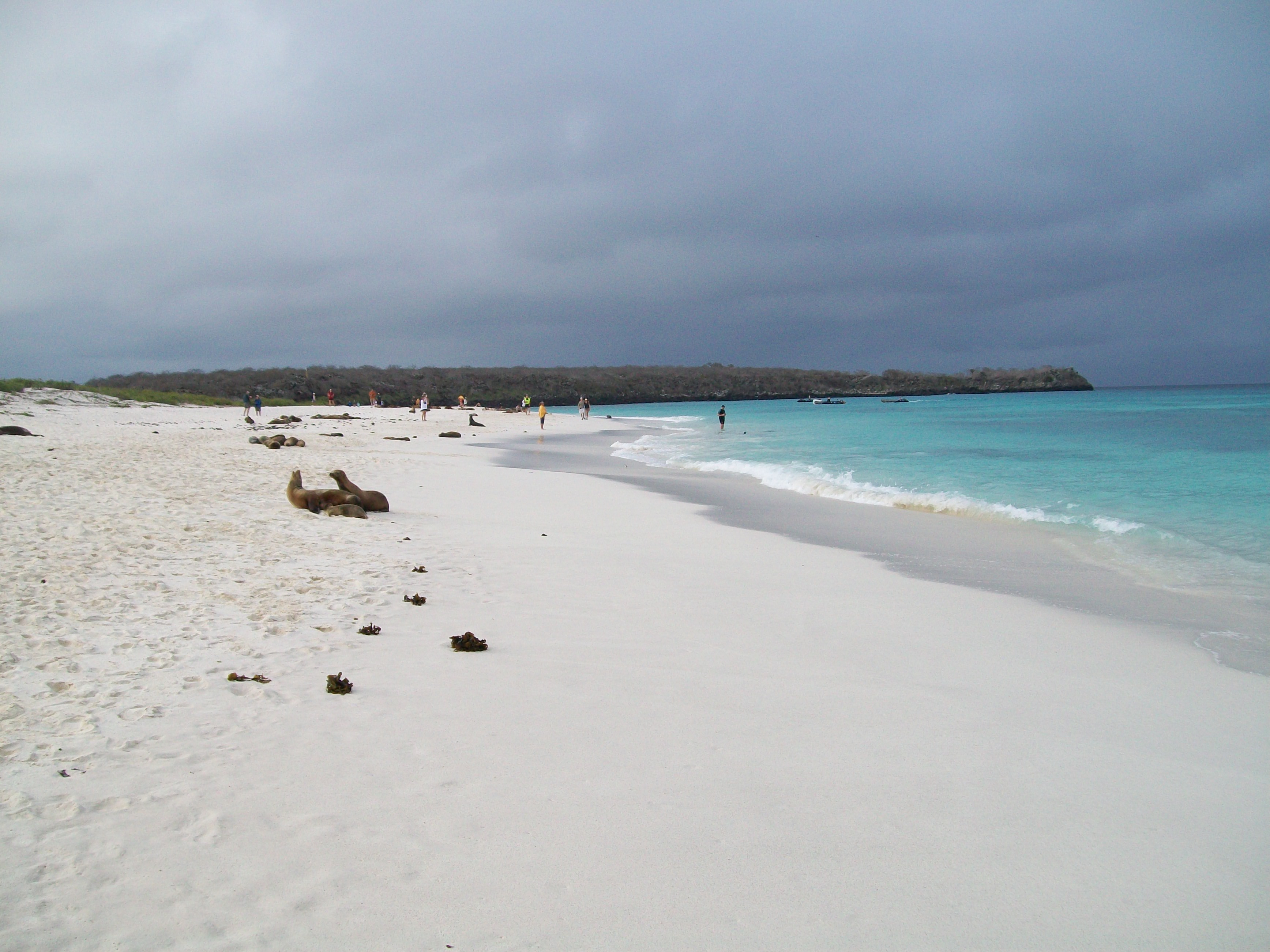
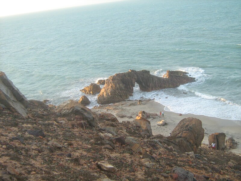
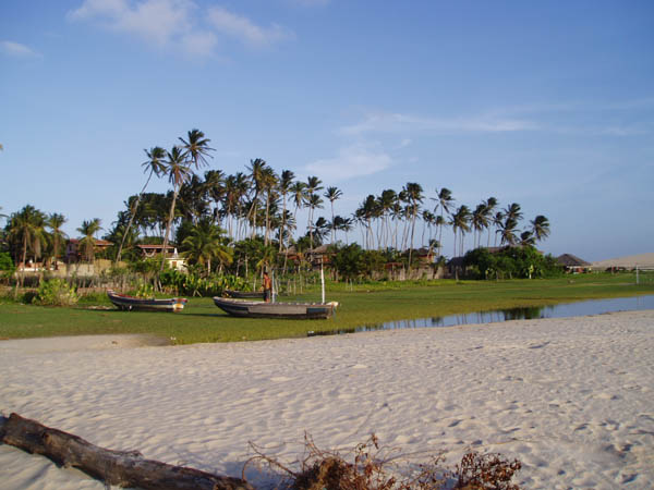
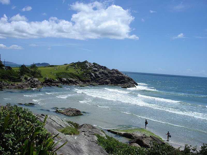
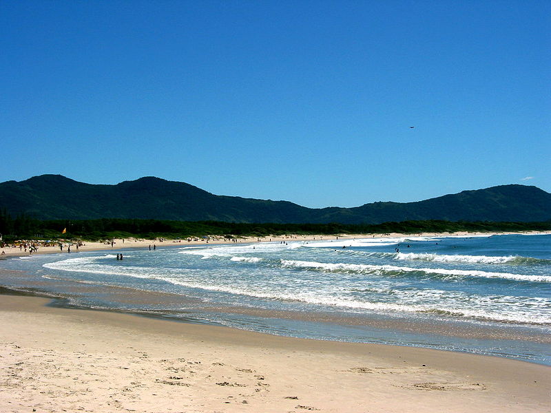
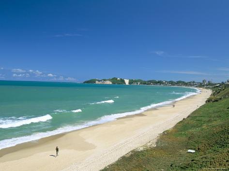
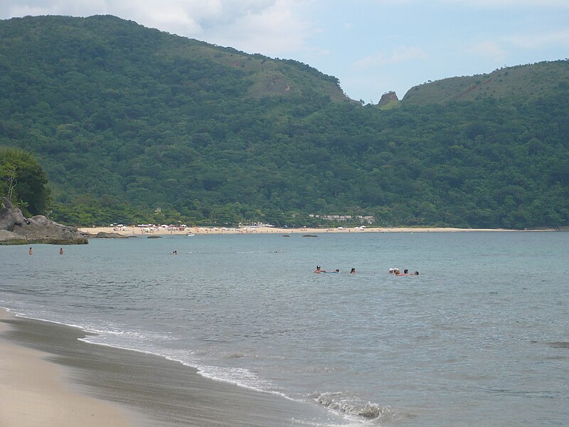
Ecuador's western coast is bordered by the South Pacific Ocean and its coastline is made up of many fine beaches of all shapes and sizes. There are also a few islands just off the coast which can be explored.

Where is Ecuador?
Ecuador officially the Republic of Ecuador which literally translates as "Republic of the Equator") is a representative democratic republic in South America, bordered by Colombia on the north, Peru on the east and south, and by the Pacific Ocean to the west. It and Chile are the only two countries in South America that do not have a border with Brazil. Ecuador also includes the Galápagos Islands in the Pacific, about 1,000 kilometres (620 mi) west of the mainland.


Montañita Beach,Ecuador

Montanita is known for its magnificent unspoiled beaches, world-class surfing and both island and mountain natural reserves. A hidden treasure that did not even appear on the maps just a few years ago, the combination of perfect waves, golden sand and tropical vegetation have slowly developed its reputation as a tropical paradise.
photo source http://www.globaltravelmate.com/
  • Montañita started as a beautiful beach with a few rustic houses of native fishermen and some surfers in tents.
  • Over time it's grown to include vacation homes, hotels, rustic restaurants, bars and open air cafès, created by people seeking to escape the frantic life-style of Guayaquil, Ecuador's largest city and main seaport. 
  • Montañita has its share of foreigners who fell in love with the place and settled down; including Argentinians, Americans, Australians, Canadians, Germans, Jamaicans, and Russians as well as people from all over Europe.

San Lorenzo Beach,Manta in Equador

Manta receives numerous visits from foreign as well as local tourists. The most visited beaches include "El Murciélago", "Santa Marianita", "San Lorenzo" and "Barbasquillo". Surfers often travel to San Lorenzo to find powerful waves (regularly head high). Kitesurfing has recently become very popular in Santa Marianita (Playa Bonita) because of the excellent wind conditions and large beach.

File:SanLorenzoManta.jpg
photo source http://www.traveljournals.net

Gardner Bay beach,Galápagos Island,Ecuador

Gardner Bay is a lovely beach and most popular among the visitors.Located in the Española Island,which is the oldest of the Galapagos Islands with an estimated age of over 3 million years.However this island is dying, slowly becoming a rocky, barren land with little or no vegetation.

File:Gardnerbay.jpg
  • this large bays, with sand and soft shingle which attracts a healthy number of Galapagos Sea Lions
  • This island has its own species of animals, such as the Española Mockingbird, which has a longer and more curved beak than the one on the central islands; the Española lava lizard; the Marine Iguana of the subspecies venustissimus, which has red markings on its back; among others.
  •  Here there are also Swallow-tailed Gulls and other tropical birds.
  • for nature lover,it is recommended to visit this place to see wildlife and some rare spots that hardly be seen elsewhere.

Sunday 12 May 2013

Gilleleje Beach,North Zealand,Denmark

Gilleleje  is a coastal town with around 7000 full year residents, it's an important local fishing harbour, and was indeed founded by fishermen as early as the 16th century.It has splendid beach for a warm summer day.
File:GillelejeCoast.jpg
  • The beach is immensely popular in the summer, and locally famous for it's white sand - many of the outlying houses are vacation homes, so you can count on the beach being full on weekends (Jun-Aug) if the weather is good. 
  • During the season, there is life guards stationed here - if you walk around 1 kilometre north west along the beach, you'll reach Zealands northernmost point, if you walk around the same distance in the opposite direction, you'll find Nakkehoved Lighthouse, which along with a sister in Sweden, marks the entrance to the Øresund sound. 

Hornbæk Beach, North Zealand,Denmark

Hornbæk is a seaside resort town on the north coast of the Danish island of Zealand(Nordsjælland), facing the Øresund which separates Denmark from Sweden. It is part of Helsingør Municipality and is located 12 km north-west of Elsinore, and is mainly known for its mundane holiday homes and broad sandy beaches.


  • When the Hornbæk Railway was inaugurated on 22 May 1906, the town was invaded by tourists. Bathing jetties and bathing huts were common along the coast.

  • The kilometre long well kept sandy beach is child-friendly and has safe shallow waters for bathing, watched over by lifeguards. 

Denmark's best beaches

Are you up to Danish holiday?Denmark is a country of beautiful coasts,it boasts many white beige sandy beaches.

Where is Denmark?

Denmark officially the Kingdom of Denmark is a state in the Scandinavian region of Northern Europe with the two autonomous constituent countries in the north Atlantic Ocean, the Faroe Islands and Greenland. Denmark is the southernmost of the Nordic countries, located southwest of Sweden, south of Norway and bordered to the south by Germany. Denmark consists of a peninsula, Jutland, and the Danish archipelago of 407 islands, which includes Zealand, Vendsyssel-Thy, Funen, Lolland, Falster and Bornholm.


Here is my best pick,

Raabylille Beach,Møn,Vordingborg,Denmark

Råbylille Strand (English: Raabylille Beach) is a resort on the south coast of eastern Møn, an island on the Baltic Sea in south-east Denmark
File:Raabylille-sandy-beach.jpg

File:Raabylille-early-spring.JPG

File:Raabylille-sunset.JPG
  • It is 9 km (5.6 mi) to the east of Stege and 15 km south-west of Møns Klint. As a result of the growing popularity of holiday homes, many of which are available for rental, it has developed rapidly over the past 30 years.
  • The sea is fairly shallow, making it ideal for bathing, boating and fishing.

Amager Beach Park,Copenhagen,Denmark

Amager Strandpark (English: Amager Beach Park) is a seaside public park in Copenhagen, Denmark. It is located on the island of Amager and includes an artificial island and offers a total of 4.6 km (2.9 mi) of beaches. It lies on the east coast of Amager Island, five kilometers from central Copenhagen. Or seven minutes if you take the Metro.
http://blogs.denmark.dk/barrett/files/2012/10/P4020011.jpg
photo source http://blogs.denmark.dk
File:Amager Strandpark - kite surfers.jpg
  • Amager Beach is a long,sugary beige sandy beach, and one of the best beaches around Copenhagen.
  • Amager Strandpark is a Blue Flag beach and the adjacent Kastrup Marina as well as the nearby Dragør Marina also enjoy Blue Flag status. 
  • From the beach, the Middelgrunden wind farm can be seen on the horizon.
  • It is allowed to have bonfires on the beach and the area is also used for kayaking. 
  • From a small headland, it is possible to go diving. 
  • There is also an area for outdoor fitness training.
  • A grassy area at the southern end of the park, known as femøren (which translates to the Nickel), is often used for open-air rock concerts in summer. 
  • There are also many Danish skaters, who skate there. 
  • The American pro skater Torey Pudwill also has a picture-ad, where he kick-flips down double set stairs at Bunker 2.


Dueodde Beach,Bornholm in Denmark

Dueodde beach is located in Denmark on Bornholm's southernmost tip.
photo source http://www.bornholmsommerhaus.de/


File:Dueodde-beach.jpg
  • It is known for its very fine white sand. 
  • The area around Dueodde was originally a large sandy area, but in the eighteenth century, it was planted with pines, as well as Ammophila and Leymus grasses to reduce sand drift.
  • Today, Dueodde is a protected area.
  • The sand at Dueodde moves easily with the wind to form dunes.
  •  The vast dune area and associated sandy beach start at Haslemere extending some 30 kilometres (19 mi) almost without interruption. 
  • Apart from the beach, the only other noteworthy feature is the Dueodde Lighthouse on the southern tip.
  • It is the tallest on the island. Built in 1962, it offers a panoramic view of the surroundings.
 

Kelly’s Beach, Kouchibouguac National Park, New Brunswick,Canada

Kouchibouguac National Park is located on the east coast of New Brunswick, in Kouchibouguac. The park includes barrier islands, sand dunes, lagoons, salt marshes and forests. It provides habitat for seabirds, including the endangered Piping Plover, and the second largest tern colony in North America.


List of beautiful beaches in Canada

Canada is indeed home for many spectacular places in the world,including it's lakes and beaches.

Where is Canada? 
Located in the northern part of the continent, it extends from the Atlantic to the Pacific and northward into the Arctic Ocean. Canada is a North American country consisting of ten provinces and three territories.
Canada locator map
  
There is plenty of best beaches in Canada,this is my best pick,


Martinique Beach Provincial Park,East Petpeswick,Nova Scotia,Canada

Martinique Beach Provincial Park situated in East Petpeswick, 11 km /7 mi south of Musquodoboit Harbour in the Eastern Shore region.Nova Scotia has a wealth of provincial parks. 

  • it is located just an hour from Halifax in Nova Scotia. 
  • With summer supervised waters, 3.7 km of golden sands, and excellent surf conditions, it’s a magnet for beachcombers, surfers, paddle boarders, swimmers and picnickers. 
  • There are change houses, outhouses, BBQ pits, and tables. Martinique Beach Provincial Park, with its dunes and white spruce forest, is also an important refuge for migratory waterfowl, and habitat for the endangered piping plover (less than 50 pairs breed in the province).
  • Some are small picnic areas, and others are large parks with a variety of facilities.

Hillside Beach,Manitoba in Canada

Hillside Beach is summer resort located on the eastern shore of Lake Winnipeg in the Canadian province of Manitoba in the Rural Municipality of Alexander.

  • Manitoba summers are short but gorgeous. 
  • With temperatures ranging from the mid 20s to the mid 30s on the Celsius scale during July and August and the fine sand white beaches such as Hillside Beach, it can rival the Caribbean in recreational value.
  • Though not as well known as Victoria Beach or as commercial as Grand Beach, it is one of the nicer resorts in southern Manitoba. 
  • It is valued by cottagers as a quiet resort with a grand two kilometer sand beach and dunes in a protected bay of Lake Winnipeg, just across from Victoria Beach. 
  • The protected bay offers good conditions for sailing, surfing, water skiing and fishing.
  •  Behind the dunes there is a large lagoon (three kilometers across) used for fishing, canoeing and birdwatching. 
  • When the larger bay becomes too choppy water skiers often prefer the quieter waters of the lagoon.   
  
Facilities and services.
  •  They mainly consist of a general store and gas station, an antique shop and a utility rental shop.
    A new addition will be a lawn care and landscaping company, like all other facilities located at the corner of Hary Craig Road and Hillside Beach Road.

Grand Beach,Manitoba in Canada

Grand Beach is located on the northern edge of the town of Grand Marais, Manitoba.
File:Grand Beach and Provincial Park in Lake Winnipeg in Fall 2008 Manitoba Canada (6).JPG
  • Grand Beach is a freshwater beach on the eastern shore of Lake Winnipeg in Manitoba.
  • Grand Beach is part of Grand Beach Provincial Park and features 3 km of fine, white sand and is backed by sand dunes that rise up to 12 meters above the beach. 
  • Grand Beach is on the historic La Vérendrye Trail.
  • A parking pass is required to enter the park. Passes are $7 for three days or $28 for a yearly pass.
     
Facilities:-
A boardwalk at the West end of the beach offers food and shopping. 
Change rooms and plumbed washrooms are available all along the beach.
The park offers 48 seasonal camp sites, 18 of which have electricity.There are 306 campsites in all about half offer electricity.

Activities:-

excellent bird watching,
cycling and hiking trails,
boating,
fishing,
kiteboarding,
berry picking (saskatoons, chokecherries, and blueberries). 

For winter season: The park could offers snowmobiling and cross-country skiing.

File:Grand Beach and Provincial Park in Lake Winnipeg in Fall 2009 Manitoba Canada (3).JPG
did it mentioned that the beach is 'freshwater'?
this is unusual place that one must see in Canada..


Thursday 9 May 2013

Pipa Beach,Natal City,Rio Grande do Norte,Brazil

Pipa Beach (Praia de Pipa in Portuguese) is one of the most famous beaches of Brazil. Located next to city of Natal, the capital city of state of Rio Grande do Norte. Is located more precisely in municipality of Tibau do Sul, exactly 84 km from the capital of the state.
File:Chapadão Pipa RN.jpg
File:Pipa beach.jpg

  • In 1626, the beach became known as Itacoatiara, meaning "the painted cliff", later becoming Ponta do Cabo Verde ("Green Headland"), and is now Praia da Pipa, or "Pipa Beach."
  • Pipa was a small fishing village until the 1970s. Then it was discovered by surfers and backpackers, attracted by a set of natural attributes rarely found even in other Brazilian beaches: crystal-clear waters, fine, white sand, areas of preservation Atlantic Forest, 10-meter-high vertical cliffs, and friendly locals.
  •  However, one should be very careful with the strong currents in the sea and the huge waves loved by the surfers but really dangerous for those willing to enjoy these warm waters. 

Jericoacoara Beach, Ceará state, in Brazil.

Jijoca de Jericoacoara or Jericoacoara Beach is a virgin beach hidden behind the dunes of the west coast of Jijoca de Jericoacoara, Ceará, Brazil. It is truly one rare paradise beach that one must visit in Brazil.
 File:Jeri085.jpg
 File:Dunadopordosol.jpg
 File:Jericoacoara3.jpg
File:Jericoacoara 08 2007 155.JPG
Jericoacoara is one of several places in Brazil from where you can see the sun sink into the ocean.
  • Selected by the The Washington Post as one of the Top 10 most beautiful beaches in the world, nicknamed Jeri, consists of blue lagoons, calm seas and huge dunes.
  • The village has streets covered in sand from the dunes by the sea
  •  Jericoacoara is a popular spot for windsurfing and sailing.
  • This show is often viewed by many, both visitors and locals, from the tall "Sunset dune" just next to the village.

Santinho Beach,Florianópolis,Santa Catarina,Brazil.

Santinho Beach (Praia do Santinho) a beautiful scenic beach, located in Florianópolis,Santa Catarina,Brazil.
Ficheiro:Costão do Santinho.jpg 
File:Santinho.jpg

Campeche Beach, Florianópolis, Santa Catarina,in Brazil

Campeche Beach (Praia do Campeche) is a beach located on the south of the city of Florianópolis, on the south of Brazil.
File:Campeche praia.jpg 
  • There are many houses to rent as well as pousadas (hostels), bars and simple restaurants
  • Praia do Campeche, one of the best beaches in Florianopolis, has great surf, budget pousadas, a party scene, and ties to writer Saint-Exupery.
 

Armação Beach,Florianópolis,Santa Catarina in Brazil

Armação Beach (Praia da Armação) is one of the best beaches in Florianópolis in Brazil.
picture source http://www.funtouristattractions.com/a/arma-o-beach-florianopolis-brazil/4095

Morro Beach,Florianópolis in Brazil

Morro Beach or Praia do Morro is in Florianópolis,Santa Catarina in Brazil
File:Praia do Morro da Pedras, lado da Armação.JPG

Matadeiro Beach,Florianópolis,Santa Catarina in Brazil

Matadeiro Beach (Praia de Matadeiro) located in the south of the island,Florianópolis,Santa Catarina in Brazil.
File:Praia de Matadeiro e ilha da Armação.JPG
  • Located between the beaches of Armação and Lagoinha do Leste, Matadeiro beach has no access for motor vehicles. This has preserved the lush vegetation of the area.
  • However, due to a pedestrian bridge linking it to Armacão, there are now quite a number of houses and bars on its waterfront. 
  • Matadeiro beach, with a strip of sand about 1 kilometer long, is very popular with surfers due to the quality of the break.
  • The beach is accessible via a pedestrian bridge over Peri Lake's drainage canal. The easiest trail follows the coast, however it is worth the walk up the hill for an unforgettable view.
  • The clear water is suitable for practicing freediving.

  • The beach has bars that are a great option for a seaside beer or aperitif. Open hours vary according to the season.
  • The locals tell of many legends: it is said to have been a center of energy , in addition to being a former home to the indigenous peoples, slaves and fugitives.

  • The view from the top of the hill is indescribably beautiful.

Ingleses Beach,Florianópolis,Brazil

Praia dos Ingleses is a beach located in the neighbourhood of Ingleses, north of the island of Santa Catarina, in the municipality of Florianópolis, capital of the state of Santa Catarina, Brazil
 File:Praia dos Ingleses, Florianópolis (janeiro 2006).jpg
  • It is a beach with 4.83 km long, open ocean, blue warm water with little waves, and a lot of sand where sandboarding is practiced by people of all ages on the beach's dunes. Boating tours are also conducted.
  • Praia dos Ingleses means Beach of the English in Portuguese. The beach's name is due to an English ship that ran aground there. 
  • The waves never get too large but there are days when they are good for surfing.

Naufragados Beach,Florianópolis in Brazil

Naufragados beach is one of the most secluded - and beautiful - of all Florianópolis beaches, located in the southernmost tip of Ilha do Santa Catarina.Praia dos Naufragados is located 43 km from the city center of Florianópolis.
File:NaufragadosBeachFlorianópolis.jpg
  • Praia dos Naufragados beach is located towards the extreme south of the island. 
  • The beach offers vast sea and thick sand, perfect for sun bathing. 
  • Along with fishing, tourists also enjoy camping and trekking in Praia dos Naufragados.

Barra da Lagoa Beach,Florianópolis, Santa Catarina in Brazil

Barra da Lagoa beach is in a small fishing village in the city of Florianópolis, Santa Catarina, Brazil. It is situated at the mouth of a tidewater channel flows either in or out of the Island's sizable lagoon (lagoa).
File:Barra da Lagoa Surfing Beach.JPG
  • Barra da Lagoa is also one of the safest places to learn to surf in Brazil.
  • There are no big rocks, sharks or deep holes and the water is usually below chest deep. 
  • Jacqueline Silva, a current World Surfing Champion lives in Barra da Lagoa
 

Canoa Quebrada Beach,Aracati, Ceará,in Brazil

Canoa Quebrada (meaning broken canoe in Portuguese), known as the pearl of the east coast of Ceará, Brazil,is an international tourist beach resort 164 km from Fortaleza, in the municipality of Aracati.

photo source :http://www.english-test.net/forum/ftopic123821.html

  • This small fishing village, among dunes and cliffs, has good views and is becoming popular with tourists. 
  • The main street of Canoa, where most accommodation, restaurants and shops are concentrated, is called Broadway
  • The nights of Canoa Quebrada are known for animation and diversity.
  • Tourist activities include outdoor activities such as excursions in dune buggies, horse riding, sailing in a 'jangada' boat, mountain biking, sandboarding, kitesurfing and windsurfing.

Ponta Negra Beach,Natal, Rio Grande do Norte in Brazil

Ponta Negra (lit. "Black Tip") is a famous beach and neighborhood located in the Brazilian city of Natal, the capital of the state of Rio Grande do Norte. Located in the extreme south of the beach is the Morro do Careca (Bald Hill), a large dune and an iconic landmark of the city.

File:Morro do Careca Natal Brasil.jpg
  • Ponta Negra beach is about 4 km long.
  •  In the south end is Morro do Careca, the most famous landmark of Natal.
  • Walking northwards, one first sees about 2km of av. Erivan Franca, crowded with bars, restaurants, hotels, party houses, small shopping galleries, etc; then, the avenue ends, and the next 2km have just a walk way, lined with small hotels and some small snack barrows.
  • The beach is completely urbanized and there are several shops, restaurants, bars, night clubs, and hotels.
  • The sand itself is lined with "tents", or huts, called "barracas" that serve food and drinks to beachgoers day and night.
  • A common sight on the beach are "jangadas", simple, multicolored, local fishing boats typical of northeastern Brazil.

Sunday 5 May 2013

Praia do Leão Beach,Fernando de Noronha,Brazil

Located in Fernando de Noronha,Brazil.Praia do Leão is the longest beach.
picture source http://neu.water-frame.com/ansicht-galerie_inseln-73-ase50045.htm

It´s named after a big round rock at the front of the beach that, in a certain angle, looks a lion laying down (Lion´s beach).
The entrance to the beach is usually closed, since it´s the place usually chosen by the turtles to berry their eggs...so don´t go there with the expectation to stroll around the shore!


Baia do Sancho beach,Fernando de Noronha,Brazil

Baia do Sancho is a beach located in the island of Fernando de Noronha.
Fernando de Noronha is home to the top two beaches in Brazil - Praia do Leão and Baía do Sancho.
Both beaches offer crystal clear blue water with areas for swimming and snorkeling. If you decide to visit, it is a good idea to bring along your own provisions as well as an umbrella as there is no shade at Praia de Leão and the shaded areas of Baia do Sancho quickly fill up with other visitors.
 

Maresias Beach in São Sebastião,Brazil

Maresias is a beach and district at the Atlantic Ocean in the city of São Sebastião, located on São Paulo state's northern coastline, Brazil. The name comes from the ocean breeze that affects the beach and the neighborhood.
File:Maresias - bresil.JPG

  • The sea at the beach is shaken with big waves and the current is also strong, being one of the most popular surf points in Brazil, serving as a point for some tournaments.
  • The sand is yellowish and soft with 5 kilometers in length. 
  • The neighborhood beside the beach attracts many tourists for its variety of restaurants and shops, but specially young people, because of its night clubs. 
  • There are also programmed walks in the Atlantic Forest.
  • The beach was discovered in 1974 by surfers who started to explore the beaches north beyond Guarujá.

Toque-Toque Grande beach,São Sebastião,Brazil

Toque-Toque Grande Beach facing Atlantic Ocean in the city of São Sebastião, SP, Brasil.
They are separated by another beach called "das Calhetas", being 2,4km away from each other.
File:Toque Toque Grande.JPG

Toque Grande House Rental Pearl Beach 4 Suites Homeaway
File:Toque Toque Pequeno.JPG
Toque-Toque Pequeno Beach as seen from Santiago Beach. 

 
  • the beach is only some 1700m long, and is smaller than Toque-toque Pequeno Beach. 
  •  Several mid-class houses surround the beach, while a couple of restaurants offer food and beverage for visitors. Most of them work only during summer, when the beach is visited by more people. 
  • At half a kilometer far from the left (Southeast) edge of the beach, there's the Toque-Toque Grande Island (larger than the Toque-Toque Pequeno Island), unhabitated and with no beaches, but frequently visited for scuba diving.
  • The top of the hill at the left of the beach can be achieved by walking.

Juqueí Beach in São Sebastião,Brazil

Juqueí (archaic spelling Juquehy) is a beach in the city of São Sebastião, São Paulo, located in the northern coastline of São Paulo state.

  • The place has white sands, green mountains and transparent water. 
  • Besides its natural attractions, Juquehy is also known for its traditional cuisine, such as "Pescado a Cambucu".

Barequeçaba Beach in São Sebastião,Brazil

Barequeçaba (sometimes spelled Baraqueçaba) is a beach located 7 km south from the centre of the Brazilian city of São Sebastião, São Paulo, following the BR-101 highway (known as Rio-Santos) which is the main road going along the Brazilian coast from Rio de Janeiro to Santos.
File:Barequeçaba.JPG
  • The name of the beach comes from the Tupi language and means "Place of sleep of the priest" (abaré ("priest"), kera ("to sleep") and saba ("place").
  • Barequeçaba combines both a permanent population, and a floating tourist population that increase during the summer.
  • The permanent population, with a large percentage of retired and elderly people ensures a range of services available on the beach during all the year, like restaurants, stores and small marinas with boats to Ilhabela.
  • The depth of the water at Barequeçaba drops very slowly and the waves are most of the time very weak, which makes the beach very popular among bathers and families with little children. For this reason, the fire brigade (responsible in Brazil for life guarding) has consistently assigned one staff member to guard the beach, even though other beaches have more than 10 life guards assigned

Itacoatiara Beach in Niterói,Brazil

Itacoatiara beach is located about 30 minutes east of downtown Niterói by car, or one hour by bus.
File:Itacoatiara beach.jpg
  • Itacoatiara is a beach with fine golden sands and bright blue (sometimes green) water. 
  • The main beach is open to the Atlantic Ocean and is dangerous for the casual swimmer while offering ideal conditions for water sports.
  • The left side of the beach ends with a rock face called Costão, and there is a wave-sheltered small beach on the right side called Prainha (little beach), which is separated from the main beach by a big rock that serves as its shelter, and which is frequented by small children and their parents.
  •  The place is famous for offering the ideal conditions for the practices of surfing, bodysurfing and bodyboarding during most of the year. 
  •  At Itacoatiara, the Atlantic Ocean produces fast and hollow waves, usually ranging from 3 to 6 feet, but on frequent occasion they might swell up to 4 meters (12 feet).
  • A few times per year a huge southeast swell can produce larger waves of up to 5 meters (15 feet) but a swell that strong rarely offers acceptable surfing conditions.


Travel Blogs

Blog Archive